Showing posts with label Camelbak. Show all posts

24/06/2012 - The Sandstone Trail - The Last Big Training Walk

When we first designed our training schedule, we agreed we needed to do a final training walk longer than half the distance of Trailwalker and one which would test our Support Team fully. From an early stage we identified the Sandstone Trail as the perfect challenge as its 55km long, local and suitably hilly. We have trained extensively on parts of the trail recorded in earlier blogs notably the hilly sections around Peckforton, Kelsall and Frodsham but there are still parts of the trail we had yet to encounter.

This would be our first training walk with a Support Team too. As Lee's brother Neil lives in Kent and Simon was inconveniently having his eyes lasered (the things folk will do to get out of Trailwalker training) it was left to Mark's wife Kate and Martin's son Ted to support us all the way.

Given that England would be kicking off against Italy at 7:45pm and our anticipated 13hour duration, we agreed (yes, we did - it was unanimous) to bring the start time forward to 6am which, given that Whitchurch was an hour away from most of us meant a 4am wake up call - a time which should be banned on a Sunday (as Kate continued to remind Mark).

The weather in recent days had been atrocious with nearly 4 inches of rain dumped on parts of the North West and more had been deposited on Saturday night and was forecast to continue on Sunday morning then easing as the day progressed.

Setting off from Mark's house at 5am, Mark, Kate, Lee and Polly again questioned why it was we were doing this as Kate drove dodging the standing water in the country lanes and we wondered what might lie in store in the fields we would have to cross. Shortly after arriving, Martin and Ted pulled into the car park and as we began to kit up, Martin announced they had driven through torrential rain on the way and he'd forgotten his coat. Requisitioning Ted's coat, Lee then announced he'd forgotten his backpack which was apparently Polly's fault (cue discussion) though he had got his Camelbak which Polly hadn't (cue further discussion). This wasn't starting well. To add insult to injury, just as we'd got suited up, the heaven's opened. Joy.

Why are we doing this again?

After posing for a quick team photo at the sandstone arch marker in Jubilee Park marking the start/end of the trail, there was a moment of disorientation as we realised we weren't sure which way to go. Finding a path and identifying our first Sandstone Trail marker on a post, we set off through Whitchurch and soon picked up the canal which would take us out of the town with Mark and Martin walking ahead giving Lee and Polly space to continue their discussion about who had forgotten what (at least that's what we thought they were discussing).


The walk along the towpath was relatively easy going, a few flooded sections easily avoided and gradually descending out of Whitchurch until we eventually arrived at the sign which would take us off the towpath into the fields. Having never done this section of the trail before, we weren't sure what to expect though it wasn't long before our worst fears were realised as evidenced by standing water and mud. As usual this was made worse by cows and cattle in the fields. 

On entering one field we realised that it was full of bulls and they were taking a very unhealthy interest in us. Instead of moving off like cows, these guys were turning to face us and follow us. Noting the stile in the corner of the field, a steady pace was maintained as the bulls started to converge on us. Somehow Mark ended up at the back of his teammates (possibly because he was wearing red and carried a red backpack - nobody wanted to be near him) and on arriving at the stile turned to face the following herd with his walking poles raised aloft stating they were actually cattle prods (patent pending) much to the amusement of his now safe teammates and the confusion of the now stationary bulls.

We had arranged to meet Kate and Ted at a lay by near Hampton Green. When we were just a few km away, Kate's voice could be heard on the walkie-talkie requesting a progress update though it appears they couldn't hear us through our rain soaked walkie-talkie. As we approached Checkpoint 1 they cheered and we arrived to find chairs set up and the boot of the car open. A variety of drinks and foodstuffs were dished out to the team as water and snacks were replenished in backpacks.

Mark had once again managed to get his boots, socks and feet wet and in changing to a fully dry set, the zinc oxide tape, damp from the walk, fell off for the second week running. Not wanting to put the stop time in jeopardy, he decided not to re-tape a decision he might come to regret with 43km still to go. After our allotted 15minute refuelling we bid our Support Team goodbye and continued up the trail looking forward to the next stop which wasn't for another 12km in the middle of the Peckforton Hills.

As we walked along more fields doing our best to dodge large areas of standing water (which was becoming increasingly difficult), we crossed though Michael Owen's (remember that goal against Argentina?) little place for the breeding and training of race horses and started to climb off the plain and up towards Bickerton Hill - a welcome respite from the surface flooding but a sudden need to adapt to going uphill again after the long muddy slog on the flat.

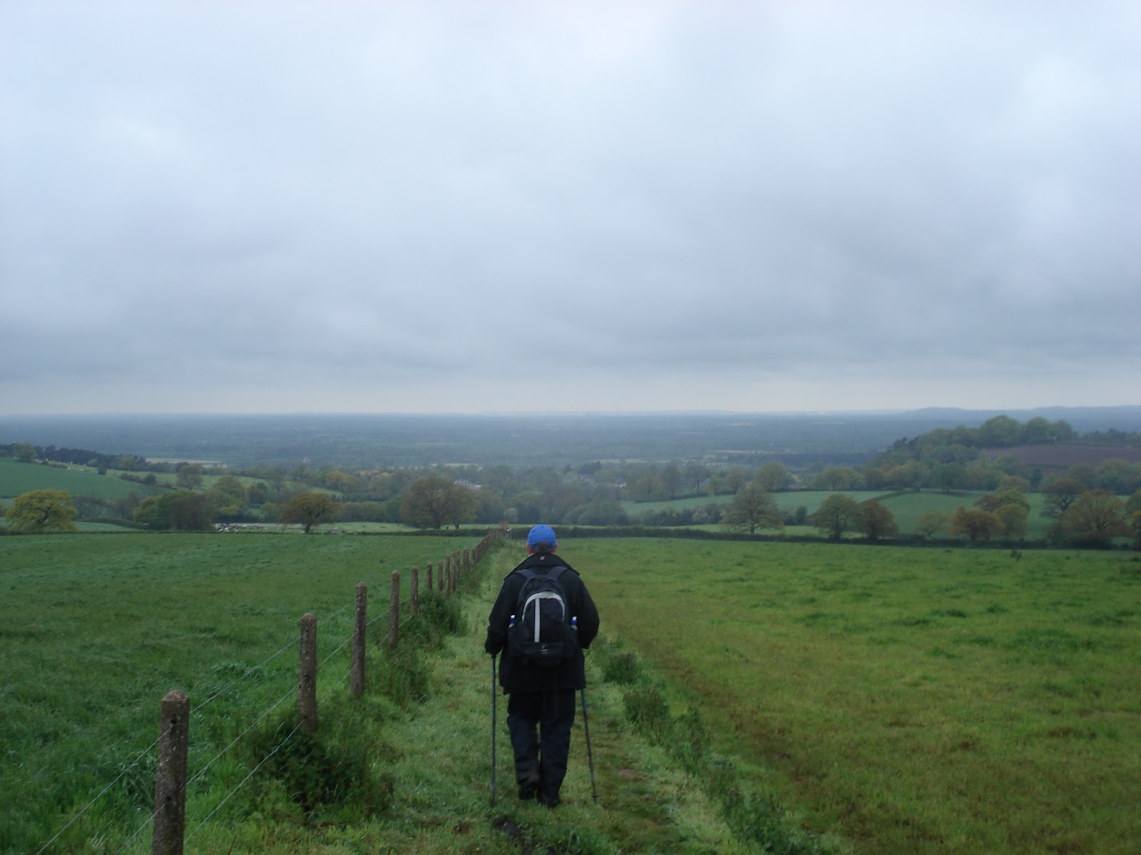
There wasn't much time to enjoy the view at the top other than to remark that as forecasted, the weather seemed to be easing and the warmth was starting to sap energy levels given we were all still in waterproofs. We also noted on the far horizon the masts at the top of Kelsall and the hills above Helsby and Frodsham - they looked a long, long way away. As we descended into the village, Mark and Martin decided to make full use of a bench in the churchyard to remove all waterproofs and while recognising this would tempt fate, it would at least make the ascent to Raw Head a bit more comfortable and we were soon on our way up the road and the gradual incline.

The walkers arrive at Checkpoint 2
Arriving at Raw Head (the highest point on the trial) we were comforted knowing it was all downhill from here, apart from all the wiggly up and down bits in between and we pushed on towards Bulkeley Hill taking the opportunity to wind Polly up about "The Tramway" and the fact she was the only teammate not to have done it yet. Given we were passing the top of "The Tramway" that pleasure would have to wait for another day but on looking down it, Polly agreed that the photos don't do its severity justice.

Choosing to ignore the ropeswing and the fallen trees, we continued into Burwardsley, home of the Pheasant Inn a previous start and stop point, but on this occasion we had chosen the car park for the nearby candle factory for our second checkpoint. This time the walkie-talkie was working and our requests for food and clothing were ready and waiting as we were greeted by Ted and Kate and some odd looks from those heading into the candle factory as we sat in our folding chairs eating, drinking and changing damped clothing - 24km done, 31km to go.

Refuelling at Checkpoint 2
Our allotted time was soon over and once again we bid our Support Team goodbye and headed back up the hill to rejoin the Sandstone Trail and the descent which would take us past Peckforton Castle and Beeston Castle, over the Shropshire Union Canal and up the notorious boggy field which Mark and Martin had encountered previously. Once again this lived up to expectations as we zig-zagged round standing water and cattle churned mud. Having got this field over with, we became more optimistic though this was shortlived as we entered fields of wheat and barley where the clayey surface had become wet making traction difficult. To make matters worse, walking poles were inhibited as the crops grabbed at the poles making it necessary to carry them and hope we wouldn't slide in the mud.

Arriving at Checkpoint 3
Persevering with the conditions underfoot we trudged on and just within 2km of our Checkpoint 3 (a wide field gateway off a country lane), the walkie-talkie burst into life with Kate asking how far off we were and would we like a hot drink? Immediately three teas and a coffee were ordered and the the thought of a hot refreshing drink spurred us on and once again Ted and Kate were ready with the drinks just at the perfect hot drinkable temperature which was just what we needed at that point - 34km done, 21km to go. 

Perked up by our Support Team we set off in good spirits and soon passed the 37km/18km sandstone marker - one-third to go. As we gradually climbed up the fields we reached the point where on a previous walk, Mark and Martin had joined the Sandstone Trail from Utkinton after which we would all be in unfamiliar territory again. At this point a further curve ball was thrown at us. As we headed towards the gate it appeared a large herd of cows had preceded us and churned the ground up so badly the mud was too deep to get through without overtopping our boots - a bit annoying having only just changed to dry socks again.

Lee and Polly did at least remember the pasta salad
The terrain continued upwards which we took as a reassuring sign that we were at last leaving the boggy plains behind and as water runs downhill, thought we'd stand a better chance of keeping our feet dry(ish). Once at the top we recognised the point at the top of Kelsall where we have undertaken some of our night walks and knew that Delamere Forest and our final checkpoint weren't far now.

The welcoming sight of Delamere Forest must have hit the team with a degree of delirium. While Polly struggled on in silence with blistered feet and Mark with damp feet and a nagging pain in the hip area, Lee, having taken twice the prescription dose of hayfever tablets (after not reading the instructions) seemed in very high spirits and as Martin dug out his iPod and plugged in the external speaker, Lee started to Moonwalk to Michael Jackson. Martin then pulled out a bunch of 'Curly-Wurlys' as we climbed the hill and we found eating these isn't conducive to walking with poles.

Mark tucks into choccie ice cream at CP4
The mayhem continued through the forest as we received odd looks from people out for a Sunday stroll/dog walk/bike ride (delete as applicable) as Martin played DJ on the iPod but given we'd gone beyond 40km, we felt we had every right to misbehave. We managed to notify the Support Team of our impending arrival, though through the trees the signal was a bit broken and they were expecting us to come from the other direction but they were there, waiting with ice-cream from the Cheshire Ice Cream Farm - what a welcome surprise!

With 8km to go and still with Beacon Hill above Frodsham to get over the team were in good spirits and determined as ever to finish albeit with Polly suffering with her feet, Mark with a dodgy hip and what was now resembling 'trench foot' from the damp footwear, Lee away with the fairies and Martin gearing himself up to run up the steps to the top. 

This was now the 'Dead Zone' as so far, only Martin had gone beyond 48km on a  previous walk. As we approached the 50km mark on the odometer, Mark counted down the last 100m and there were handshakes all round - half of Trailwalker in 11hrs 15minutes and then we moved on knowing the job wasn't done yet.

Nearly there!
As we climbed, conversation dropped as we focused on this final ascent, one which we have done on several training walks before and knowing this would be the final climb before the descent into Frodsham. Approaching the '39 steps' (we're not sure how many there are as we've not actually counted them), Lee, Polly and Martin took off, leaving Mark to climb them at  a more sensible pace and we were soon at the War Memorial at the top of Beacon Hill and radioed the Support Team of our arrival at the top. Just another couple of kilometres downhill to the finish now.

Dropping down into the streets of Frodsham, we probably looked a right rag-tag bunch with muddy boots, gaiters and trousers and with it being quite a nice evening there plenty of people about and drinkers outside pubs preparing for the England game. The final point of the trail is a sandstone obelisk conveniently located outside the Bears Paw. Once again Kate and Ted were there to greet us and capture this finish and even better  - there waiting was a celebratory pint for each of us - great support.

This is the end - 55km - 12hrs 32minutes.
As we sat downing our pints, rubbing our sore and aching area sand stretching, we contemplated the fact that on Trailwalker, we will still have 45km to go which was basically turning round and going all the way back to Checkpoint 1. Food for thought.

We would like to thank Kate and Ted for being a great source of motivation throughout this walk and we couldn't have done it without you. The route is here.

Things learned from this long team walk:

1. Lee and Polly need an equipment list,
2. Mark needs better zinc-oxide tape,
3. Polly probably needs to use zinc-oxide tape,
4. Martin likes Ted's coat better than his own,
5. You can never have enough dry socks,
6. Its amazing just how much punishment your body can take,
7. Painkillers are useful when your body can't take much more punishment,
8. Walkie-talkies are very handy to communicate with the Support Team,
9. Checkpoints become a very welcome sight,
10. Nice surprises are quite motivating.

26/05/2012 Training in the Akamas Forest - Cyprus

Now just because you're going on holiday, doesn't mean you can skip the Trailwalker training schedule I told myself. A holiday in Cyprus and staying right on the edge of the Akamas Forest offers a wealth of training opportunities in a place I've visited on several occasions over the years. The only issue was that this training would have to be done solo as my wife Kate having been dragged on a 10 miler last year informed me "Never again" and my in-laws having been dragged up what we now call "Andrew's Mountain" three years ago (more on that later) were somewhat reluctant to join me again and opted to stay by the pool.

Andrew's Mountain in the middle seen from the villa.
This left a few logistical issues to deal with. Firstly, before working out how far to plan, I'd need to work out how much water I'll drink to ensure I can get back without becoming dehydrated in temperatures pushing 30 degrees. My Camelbak is a 3 Litre and I can carry an extra bottle so planned for 4 hours. The second issue was the midday sun, from past experience, not something to be out in here and conform to the 'Mad Dog and Englishmen' stereotype. I decided I'd do two walks, one setting off early and returning by 11am and then a second setting off around 2pm to avoid the worst of the heat and test my recovery powers.


The picnic area at Smigies
Up at 6:45am (an ungodly hour in anyone's dictionary but on holiday it should be illegal) I was on the trail at 7:05am. My plan was to walk from our villa, into the Akamas and reach what we call Andrew's Mountain. 

The real name for this hill is Pano Vahines a flat-topped hill at 370m above sea level. The story behind its alternative naming is that three years ago, I dragged my father-in-law Andrew and his partner Helen out for a little stroll. After taking a the wrong path (the maps aren't good here) we ended up climbing upwards from near sea-level along a zig-zagging goat trail. About half-way up, Andrew informed me he suffered from vertigo and froze.

Faced with calling in the helicopters we managed to inch our way upwards with him looking at his feet and me on the outside of the trail stopping him looking down. While he was a nervous wreck at the top and drenche din sweat - he did it and since then we've renamed it in his honour.

This chap didn't make it across
This time however, my plan was to take the widely used route behind the mountain and a route which would take me about 10km to the summit and the same back again. The bonus of setting off early is the serene peace of the place around you - nobody about and nature just beginning to stir onto life. I was soon past the popular picnic area at Smigies and along the trail past the Fire Lookout Tower. The one thing to be wary of in the Akamas is snakes. There are 8 different species from memory and most are harmless but the one that is potentially deadly is the Blunt-nosed Viper. Up until last year, I'd never seen a snake in the Akamas until a 6ft long black snake crossed the trail infront of me and my wife so I am constantly scanning the trail ahead these days.

Looking northwest from the top of Andrew's Mountain
The dusty trail winds in and out and up and down and most of the time the summit is in view but seemingly not getting any closer. The air was starting to warm up rapidly and the white dust of the trail reflected the heat and light making shades essential to avoid 'snowblindess'. 

One useful hint I've picked up is to blow back the water in the Camelbak once you've had a sip - this avoids the water in the tube becoming tepid and keeps the contents of the Camelbak cold even after four hours in the heat.

Eventually I reached a familiar section of road leading to the base of the mountain and was soon hiking to the summit. 

Reaching the top at just under my 2hr target, I decided to down a banana and an Alpen bar while taking in the view and looking down at the goat trail below the cliff - perhaps I'll get chance to drag my wife up it before this holiday is out.

Grasshopper Island
A quick check to see how much water was left in the Camelbak found it was about half-way and I was soon off on the return leg of the walk back to the villa. The whole time I passed one Cypriot in a pick-up and a couple sat at one of the benches at the Smigies picnic site and that was it managing to get back to the villa by my 11am target time completing the 19.3km with 496m of climb in 3hrs 47mins. 
Returning back to the villa for a cooling swim and a bite to eat, I noticed I'd rubbed up a blister on my right heel - not somewhere I'd previously had a problem with so dropped a blister plaster on it and taped my feet up (having decided not to bother in the morning). The right calf was feeling tight again and no attempts at stretching seemed to relieve it which didn't bode well for the afternoons walk. 

The west side of the island looking south to Seacaves
Setting off for the Akamas again at 2pm was a little harder but once again I headed towards Smigies via a different route and my plan this time was to head to the coast path and go South. This is a route I have not been on since I was on holiday here 7 years ago and was joined by Red Leader as we inadvisably took a hire car along this route built for four-wheel-drives and mountain goats only and I'd forgotten the twists and turns as the road winds in and out of the mountainside, descending to a low point before climbing all the way back up. While the view across this side of the island is spectacular, you have the feeling of going nowhere fast thanks to the constant twists in the road.

Here come the goats - let the staring commence
My plan was to walk for 2hrs or about 10km and then turn and head back. As the road climbed to the top again I came to a junction in the road and realising that I could get back to Smigies a different way, I decided to risk the unknown and take the different path. I was quickly met by herd after herd of goats who regarded me with instant suspicion and froze dead in their tracks. As I continued to approach, panic ensued as the goats realised I was still coming towards them despite their best efforts to stare me out. Scrambling up the sides of the trail, the goats parted in front of me obviously terrified they would end up as some sort of kebab.

Welcome to the Wild West - Hunting Prohibited

This was obviously a more popular route than the twists and turns of the coast road as first quad-bikes and then hired hatchbacks came trundling past me leaving me wondering how it was we didn;t find this road 7 years ago and instead endured the twist, turns and cavernous potholes of the coast road in our humble hire car. This was also backed up by the route being 2km shorter on the way back than it was going thanks to the twists being ironed out getting me back to the villa well ahead of schedule after the reduced 16km walk with 412m of climb in 3hrs 13minutes


The days total stands in at 35.3km, 908m of climb and 7hrs of walking which was a pleasing total in the heat and good preparation should we by some miracle have a proper July for a change. 

Things learned from this hot walk:
1. Water consumption was about 50% higher needing about 650ml-700ml per hour
2. Blowing water back down the tube of your Camelbak keeps it refreshing
3. Factor 50 does the job nicely - no sunburn after 7 hours in the sun
4. Feet sweat - a lot - definitely change those socks
5. A change of underwear is advisable - must look at wicking pants!

19/05/2012 - Plains, Trams and Watery Fields

Lee and Polly were off to the Yorkshie Dales this weekend for a friends birthday - but no doubt they would be getting some miles in. It was left to Mark and Martin to hit the trails locally this weekend. 

The weather forecast wasn't looking great for Saturday. Mark had planned two routes depending on the weather, one on the Clwydian Range (not great in poor weather) and another on the Peckforton Range in Cheshire (not great in poor weather - but better than being exposed on the Welsh mountains). Both walks were anticipated to be 7hours of walking (excluding breaks). We opted for the Peckofrton Range as the forecast was showing rain into mid-morning and the 34km planned route was logged into the Garmin.

Driving through persistent drizzle on the way to rendezvous at The Pheasant, did not bode well for today's walk. Mark had fully filled his 3Litre Camelbak and thrown in two bottles of Lucozade Sport for good measure, a handful of Clif Bars, a tuna and cucumber sandwich, two pairs of socks, a mid-layer fleece as well as all the usual navigational paraphinalia he carries - seldom had his pack weighed so much. In true F1 style, we agreed on a two stop strategy of not more than 10minutes to try and start preparing for being supported by our crew. The plan was to stop after 2.5 hours and 5 hours leaving us a 2 hour walk to the finish.

The Tramway from the bottom
We set off from the Pheasant at 9.10am and headed off for the trail which would take us to the now infamous Tramway (see our previous blog on this). Now Mark had yet to experience the Tramway. He had heard the tales of those who had gone before him and survived to tell the tale. "How hard can it be?" he asked himself having previously survived The Cloud cliff path and Shutlingsloe Hill. On approaching the bottom of the Tramway - he soon had his answer.

The vision of two parallel lines disappearing and curving upwards was enough to turn the legs to jelly even before we got started. Martin explained there was only one rule - no swearing on the way up. A few gulps of water and and a with a wry smile from Martin they set off. Mark was soon regretting tackling this early in the walk with a full backpack. The 'no swearing' rule was quickly broken and Mark was not even half way up before the burning sensation in the calves started. 


Step by gruelling step we climbed, the mud in between the sleepers slippery underfoot, the distance between the sleepers making it a further to reach than climbing steps and as we got further in, it began to fell like a ladder - Jacob's ladder perhaps, we're ascending to heaven, we must be dead - Mark began to hallucinate as the sound of his heartbeat pounded in his ears and Martin decided to film it so that it could be enjoyed posthumously by others who thought to attempt the Tramway.

The drizzle keeps on coming...
At last we reached the top, legs completely jellified and looked back down the track now looking more like a descent into Hell than a Stairway to Heaven. Other than that - we  can thoroughly recommend it! Gradually descending Bulkeley Hill with heartrate recovering we headed gradually down the back and round Bickerton Hill. 

As we began to climb towards the summit, we realised we'd taken a slight wrong turn and were meant to go down to the bottom again before taking a trail up the face. Retracing our steps we were soon looking up the face of Bickerton Hill but the marked path was nowhere to be found until we spotted what looked like a trail running straight up the face. 
"That must be it" we decided so started on upwards only to realise that this was probably a route cleared by badgers as the undergrowth soon closed in on us. With the Tramway only a recent memory, we found ourselves once again heading steeply upwards on not so much a trail as a stream bed carved out by rushing water. Eventually we returned to the trail at the top which took us round the top fo Bickerton Hill as the drizzle beagn to ease and we began to descend once more.

By the time we had reached the bottom of the hill we were bang on 2.5 hours and searched for a convenient perch for a pitstop. Martin managed to make a bus-stop magically appear so the opportunity was taken to take a load off, scoff a sandwich, Clif bar, down a bottle of Lucozade and change socks (well for Mark in anycase). All managed nicely in 10 minutes and we were off again pleased we could manage it in the allotted time.

Looking out from Raw Head
The quick re-fuel stood us in good stead for the ascent to Raw Head, the highest point on the Sandstone Trail and this was quickly dispatched as we headed back towards The Pheasant to mark the first half of the walk and bottom part of this 'figure-of-eight'. At 3hrs and 45minutes for the first half of the walk (the hilly bit) with a stop thrown in we were quite pleased with progress knowing the next half was out onto the Cheshire Plain and other than the ascent at the end should be quick. What we had failed to take into account however was that water runs downhill, off mountains and into fields.


The Cheshire Plain unfolds in front
Passing first Peckforton then Beeston Castle and over the Shropshire Union Canal, the Sandstone Trail  became a tad boggy underfoot. This was nothing compared to what was to come. The route took us off the Sandstone Trail on a public footpath towards the Eddisbury Way.

As we approached the point we would leave the Sandstone Trail, there was no sign of the footpath as the farmer had recenlty tilled the field. Nothing else for it but to plough on (pun intended) across the field gradually picking bits of it up on our trail shoes as we progressed and feeling steadily heavier with each step. Finally reaching the stile in the corner of the field we hopped over to find a field full of thigh deep (waist deep on Martin) wet grass and no desire line where the path should be. A quick glance at each other and across we went boldly going were others seemed to feared to have tread. At least the grass had cleaned the mud off the shoes and we expressed relief we had yet to remove our waterproof trousers. This was proving harder going than the hilly section.

Beeston Castle
Climbing over a stile-bridge-stile combination, Mark managed to slip and plant his left foot briefly into a pool of stagnant water - not pleasant but merely preparation for the next field. An electrified fence guided us along the boundary of the field until we reached a flooded section of ankle deep water. Nowhere to go other than over the electrified fence and round it. 

We soon found however that the field was perhaps more suitable for the growing of rice. With each step we found water deeper than our boots would permit and after several attempts at trying to find dryish spots, we decided to embrace our watery fate and just went for it. 

Once again we broke the 'no swearing' rule as we splashed through the flood knowing not even the miracle of GoreTex would be capable of preventing the inevitable squelchy trudge that would follow.

After clearing what we hoped would be the worst of the fields and reaching the Eddisbury Way and concluding this must be better- because it has a name (though I won't share the string of expletives we called the preceeding footpath) we decided to at last have a well earned pit-stop after 5hrs and 45minutes. Again setting aside 10 minutes, Mark demolished his other sandwich, a Clif bar, downed another bottle of Lucozade Sport before changing his socks and retiring a fairly sodden pair to the backpack. It was also welcoming to ditch the waterproof coat and change the sweat-soaked T-Shirt (a big welcome relief). As Martin's change of socks were waiting at the car, the best he could do was tip the surplus water out of his boot and then we were off down the Eddisbury Way which was mildly better than the 'Footpath-now-known-as-a-string-of-expletives'.

Having damp feet and soaked boots raised the increased possiblity of blisters as the skin softened, but there was little choice than to press on. As we did so we came across several groups of DoE teams and not wishing to look like a pair of guys, who are walking this way because they've already done 25km and have soaked feet, we set about overhauling the whipper-snappers and by the time we came to climb Peckforton Hill, we had overhauled three of the teams. Feeling chuffed, we hit the hill with gusto and hit the magic 33.33km figure at 7hrs 20minutes - one-third of Trailwalker! Mulling over what time that might translate to over the 100km we hit the next obstacle, a series of stepped plateaus created with logs, each one seeming to get higher than the preceeding one. It was good to see after this length of walk we still had enough in us to climb and then we were descending through the grounds of Peckforton Castle and out of the gate.

Martin then reminded Mark we still had to go up through 'that field' and it dawned on Mark the climb wasn't yet over and worse still, the field had also just been tilled, meaning another long trudge over freshly turned soil. At last coming over the final hill and descending to The Pheasant, we realised how much our feet were aching and mulled the prospect of having to do it another two times to reach Trailwalker distance. As we reached the cars and began to deposit our gear, Martin removed his socks and wrung out a trickle of water from each and after a quick change into dry socks and trainers, we walked like a pair of gunslingers into the Saloon of the The Pheasant and downed a pint of Weetwood's finest. Never has a pint tasted so good or been drunk so eagerly (well except perhaps in Ice Cold in Alex).

The walk turned out to be 36.53km with 706m of climb in 8hrs 8minutes and thankfully we were blister free.

05/05/2012 - Trailwalker Prep Session and Training on The South Downs - Pt1

This Saturday was the Oxfam Trailwalker Preparation Session at Queen Elizabeth Country Park. We had decided to book the 9.30am session to allow us time to get training for the first time on the South Downs Way afterward.

Martin had already decided it was too far to drive down and decided he'd rather stay and watch the footie. Lee knowing his issues with timekeeping had driven down the night before with Polly and Simon had stayed overnight in Banbury. Mark decided to drive the 200miles on the morning and arrived bright and early at the Visitor Centre at 8.30am and was shortly joined by Simon. No sign of Red Leader and Polly but theres was still plenty of time for him to make an entrance, though we weren't expecting it to be at 10:15am due to breakfast being served late and a 'navigational time issue'. Lets hope things are smoother the next time we come here!

The running order was Tom from Oxfam, followed by Gurkha Gopal and then Tony, Mark and Jo from the Brixham Badgers.

Tom is doing Trailwaker with a team himself and has been training on the course. He ran through training schedules, team roles and the support team role and then it was over to Gurkha Gopal .

There he was stood in combat gear, a little guy with a great smile and sense of humour but obviously as hard as nails. He explained that he'd done Trailwalker four times, three times in the UK and once in Australia. His fastest time was just over 11 hours and his slowest around 14hours though this year he doesn't have a team - yet.

He went on to explain how the Gurkha's approach this 'run' (a term he continued to use much to our amusement). He explained that they spend no more than 2 minutes at a checkpoint enough to charge themselves with fuel and change socks though he confessed he wears the same pair throughout often wearing a hole through them! This F1 style of pitstop was made more interesting when he added that their Support Team have to point their vehicle in the direction of the exit to ensure they make it to the next checkpoint before them! By all accounts they don't drink a great deal as he indicated the team go through about 30litres of water between them. For salt replacement, they use sliced apple sprinkled with salt.

He ran through the timings of the starts and the need to register on the Friday evening and that the Gurkha Cultural Event is a must attend to get into the spirit of Trailwalker. He did also say that while camping is available at the start this may not result in a decent nights sleep which is why the Gurkhas stay away. Interesting to note was that camping is available at Brighton Race Course from Saturday evening so the Support Team can set themselves a base.
 
Water is available at checkpoints to top up bottles and camelbaks though this may mean queueing so perhaps sticking with Plan A and carrying our own water is best advised. Sometimes food or chocolate bar treats are available at intermediate checkpoints along with hot/cold drinks and at checkpoint 7 there is a hot meal though he cautioned that a lot of people drop out here. This he put down to a combination of it being night, tiredness and then taking on board a meal so perhaps caution advised not to eat too much or linger too long. The Gurkhas will be there to applaud us in at each checkpoint and motivate us with the sound of the pipes at the finish line.

Next up were Tony, Mark and Jo of the Brixham Badgers. Like us they had lost a teammate in training and had to replace him and they stressed the importance of training on hills to prepare for Trailwalker. Their training adopted the '10% Rule' gradually increasing the distance each week in the run up to the event. Their plan was to build in time in the second half of the walk and gain encouragement from beating their plan which included blitzing the hill in the final stages.

The support team were very well organised. Each walker had their own box of clothing and gear. At each checkpoint, the walkers were greeted by the support team and lead to the vehicle where 4 chairs were arranged around a square blanket with their stuff infront. Pit stops were kept to a minimum 20-25mins with the exception of one afforded half way of nearly an hour because the team were well ahead of schedule. The Support Team used a flag mounted above the vehicle so it could easily be found at each checkpoint and this was handed to the team at the last checkpoint so the support team could see them coming and cheer them in at Brighton.

It was also interesting to note that Support Team members can walk down the trail to meet the walkers, take instructions and run back to the Support Team. They can also walk with the team up the trail from the checkpoint as a boost before turning round and coming back.

Last year they explained it rained for the first 10 hours and suggested that 'waterproof' is a relative term. Beyond the halfway stage two of their teammates started to suffer with knee and foot problems including monumental blisters and continued the rest of Trailwalker in pain which apparently was only eased with the use of walking poles. On the same subject, they recommended anticipating pain management and alternate between nurofen and paracetamol over the duration of the walk. Despite the adversity of injuries and bad weather, they managed to complete the walk in 27hours 53minutes raising £2,770.50 for Oxfam and The Gurkha Welfare Trust. To read their blog in full you can find it here.

The Prep Session ended and we agreed it had been a useful experience especially to listen to those who had been there and done it. One thing that doesn't really come out in blogs is the mental and emotional side of doing this as everyone expects physical pain. The Brixham Badgers managed to reduce a few members of the audience to tears as they described their highs and lows - we need to prepare for that. Thanks to Mark, Tony and Jo for putting it together and getting up at 5am to be there.

We headed for the cars for the next phase of the day - training on the Trailwalker Route at last.

10/03/2012 - Training Walk #7 - Electric Stiles, Udderless Cows and a Frog Chorus

For this training walk, Mark was trying out a touch of lemon juice in his Camelbak. Camelbak suggest its use to give more of a refreshing taste, remove the plastic taste and for anti-bacterial reasons.
Lee arrived at Mark's house for 8.30am and was on time for a change (there you go Red Leader - I said I would let everyone know). For this training walk, Mark was trying out a touch of lemon juice in his Camelbak. Camelbak suggest its use to give more of a refreshing taste, remove the plastic taste and for anti-bacterial reasons. The MapMyHike app was also being given another try as we were in a good mobile reception area.

Shocking.
We set off on our usual route to Mow Cop at a decent pace. The 3.6km, 200m ascent to the Folly at the top was managed in 46minutes which is about as fast as we did it with the full team. Having got our passports stamped to cross the border into Staffordshire, we then descended into unknown territory, weaving our way down streets and across fields. There was a bit of confusion where the public footpath left a street and all evidence of said footpath through a farm had been removed. We carried on regardless and soon found that there were stiles present albeit we got the impression we weren't wanted there given they had been electrified with a cattle fencing wire!

Biddulph.
Once through the electric fence and across "No Mans Land" which had been badly churned by livestock, the town of Biddulph came into view. Crossing further fields, we came to a another farmyard where the footpath went through it, though the marker was pointing across the field. Realising the marker had been removed and replaced with a single nail allowing it to be spun, we carried on to the farmyard. We were greeted by a friendly farmer who told us we were just in time as they were about to let the cows back out and often they divert people around the farm into the field (hence the marker). Directing us through the farmyard, we hastily made our exit as the thought of charging cows didn't appeal.

An old platform on the BVW. We apologise for the delay....
A short distance later we joined the Biddulph Valley Way (BVW). The BVW is a former railtrack which was once used to carry coal from The Potteries to Congleton and sand on the return journey back (more info can be found here). The route is now part of Cycle Route 55 and is heavily used by local walkers and cyclists young and old. The section we were on is a gradual descent towards Congleton so we set a good pace along it. 


As we got further down, we approached a group of people who were looking at something at the side of the track. The surface of the water seemed to be alive and it turned out to be a myriad of frogs who were spawning. A local lady explained that they return to this same spot to spawn every year. If you listen carefully in the video, you can just about hear them.


This stile has seen better days.
A short distance later we veered off the BVW onto a seldom walked public footpath. The stiles were in poor condition and livestock had turned the field into something more reminiscent of The Somme making it heavy going. We then realised we could have stayed on the BVW a bit longer adnd descended onto out intended route which probably explains why it is seldom used and the look of puzzlement on a lady's face who saw us on it (D'oh!). Well, we'll know better for next time. A quick delve into the backpack for an energy bar and a check of the watch suggested we were well ahead of schedule and making good time.


From this point, it was uphill through fields and woodland towards Congleton Edge. This turned out to be a very pleasant route through woodland though again boggy in places and eventually we emerged at a familiar junction at the top of the ridge. Once on the ridge we headed towards the mast at Mow Cop at which point Mark realised his Camelbak was empty, the full 2litres had gone in 3hrs which was either down to the lemon juice or the fact it was a warmer day. Instead of going straight on, we headed down the South Cheshire Way across the fields and through woodland. Again the woodland conditions weren't great with Mark narrowly managing to keep his footing on two occasions.

We ended up entering a field full of cows, at least we thought they were all cows until we approached to find one had a ring through his nose and a quick glance clarified he didn't have an udder. Hastily we edged along the field with half an eye on our curious friend and exited onto the road which took us towards the Start Line for the infamous Mow Cop Killer Mile.

Following the road back, another glance at the watch suggested we might manage our route in under 4hours so with that in mind we cracked on reaching the finish in 3hrs 50minutes having covered 18.5km with 383m of climb and descent a good 40minutes faster than we expected at an average speed of 4.8km/h. The stats for this walk are here.

The MapMyHike info is here (though I forgot to turn it off after the walk had finished!) Not a bad test for it though the elevation data is questionable.

10 Things we learned on this walk:

1. Adding lemon juice to your Camelbak improves the taste and drinkabilty
2. Warmer weather will make you drink more - today was about 650ml/hour
3. Ibuprofen is a surprising performance enhancer
4. Be wary of electrified stiles
5. Cows who don't have udders might not be too friendly
6. Walking through fields full of cows leaves something undesirable on your boots
7. Walking poles may double usefully as cattle prods
8. Walking poles may conduct electricity
9. Thanks to his new knee support, Lee's dodgy knee didn't kick in after 10 miles
10. Setting a target time and beating it is a great training motivation