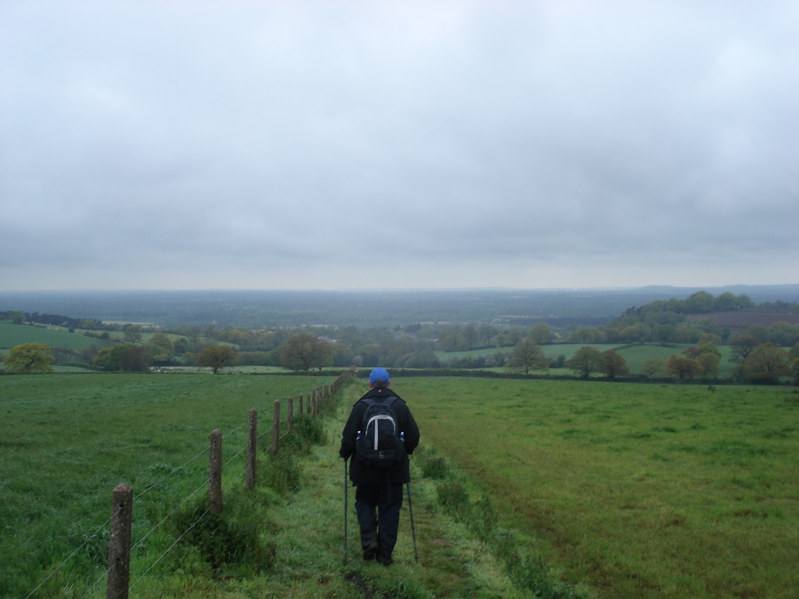
Showing posts with label Garmin. Show all posts

10/07/2012 - Preparing for "The Big One"

Following the elation of completing the Sandstone Trail and getting a small taste of just what we've taken on with Trailwalker we thought we would update on our preparation for "The Big One".

After managing to stay relatively injury free through training, we've managed to pick up a few niggles. We put this now down to now being such finely tuned athletes after all this training. After suffering pain in the hip that wouldn't go away after the Sandstone Trail, Mark went to see a Physio who diagnosed an issue with a tendon relating to the 'Glute Max' (basically a muscle in the left side of his backside). Stretches and strengthening exercises have been prescribed three times a day as well as physio sessions to try and ease the problem. At the suggestion of walking 100km, the Physio shrugged, shook his head and told him "We'll tape you up but be under no illusion - it's going to hurt". Great - painkillers it is then.

Lee on the other hand has gone downhill since completing the 55km walk and his recurring knee issue has come back on top of which he seems to be getting some sort of cold/flu/bubonic plague so will be readily identifiable by the sign "Unclean" hanging round his neck and his little bell so all can avoid him on the trail - it is only 100m we can be apart isn't it?

Polly is still recovering from blisters and ankle issues and has been practising with zinc-oxide tape with success (though some of the early attempts were somewhat amusing). Only Martin, (the oldest member of the quartet) is injury free, either that or he's just not moaning about the injuries he does have like the rest of us.

We arranged a meet up at The Pheasant the following Sunday after the last walk with full Support Team to have a 'post-mortem' on what worked well, what didn't and what we needed. We've decided to run with three support members, one vehicle for support and one in reserve with stock to be parked/abandoned along the route. This was mainly because the Support Crew don't want to miss any of the action and they feel they can cat nap if they need to when they get tired. We'll probably find out how good this strategy is when we arrive at Checkpoint 7 to find they're all asleep in a lay-by somewhere.

That should do us for Checkpoint 1 then.....
In terms of team actions, Kate was tasked with supplies having collated the team's wish list of goodies and went shopping (something which she has a particular talent for) and came home with an impressive haul of Lucozade, peanuts, Mars, Snickers, Dairy Milk, Curly-Wurlys, tea, coffee, Soreen, soup, plastic cups/plates, Champagne and a bucket - most of which is just for Martin. Simon as Support Team leader has been digesting the Trailwalker info and planning the logistics as well as organising the team T-Shirts (red of course). Mark has programmed each stage into the trusty Garmin that has seen us through all our training walks so far and worked out the team timings for each stage so the Support Team have some sort of idea where they need to be and when.

Sorry, really should've got the brakes checked....

The final bits of kit have been purchased and assembled including a Mobile Field Command Centre (gazebo) to allow the Support Team some dry space at the back of the car and the walkers to shelter during breaks at each Checkpoint. A trial packing of the car has been undertaken to ensure we can get the three support crew members, team clothes boxes, food boxes, gazebo, four folding chairs, folding table, cool box, water containers and all the other bits and pieces in.


When I said "Less than 100m apart....."

In between all of this shopping, tapering, organising, we did manage to take a break and enjoy a bit of rest and relaxation at the British Grand Prix on Sunday. 

Though we did mis-read the itinerary and thought we were down to do some sort of display, but apparently there's some air display team called the Red Arrows - what a coincidence! They weren't bad either.


OK...new game - Spot The Red Harrow
So all that remains really is the weather, which isn't looking too good. The rain just doesn't seem to want to stop at the moment. Just about every Trailwalker team must be logging into the Met Office but as it stands, it looks like Friday will be very wet, Saturday will be drizzle and showers all day into the evening before clearing up overnight and into Sunday morning. With 800 walkers off before we hit the trail, it's likely sections of the trail are going to get muddy and churned up before we even get there. Not what we all hoped for but at least we've trained in these conditions so know what to expect. Hopefully we'll see a welcoming sunrise as we head towards Brighton on Sunday morning.

On a more positive note, we've had a string of donations of late and as of today, we've gone through the £4,000 milestone with a total that now sits at £4,207.14. We had hoped to get past the £4,000 level before the event and this has given us a massive morale boost as we never imagined we'd raise this much!

We would like to thank, David Hall-Matthews, Hannah Jones, Pearl Engineering Services, Polly's Dad, Mette, Shelly Margolan, Margaret Yorke, Peter and Melanie Yorke, Tracey Statham, Mark Smith, Helene, Lucy Hopkins, Stuart McAnulla, Audrey, Eleanor Walker, Tim Noden, Audrey, Derek Edyvane, Lucy Webber, Jonathan Dean, Julia Harper, MGL Demolition, Andreas, pukeko, Hetta, Gordon Crawford, Andy Porter, Kevin Theobold, Chris Haslam (again!), Fellow Trailwalker Team Jon Paul Tom and Olly, Paul C, Martin's Mum and Dad, Jayne, D. Morgan PLC and our Anonymous sponsors for getting us through this major milestone - we can't thank you enough!

For anyone wishing to follow our progress on the day, we are off at 8am on Saturday morning and Oxfam have a live blog running and you can follow our progress as we pass through the Checkpoints. Alternatively, we will have our Satellite tracker with us which you can see on this web link and it should update every 10-20minutes as we walk along the trail. Please also feel free to follow us on Twitter and tweet us some encouragement which our Support Team will relay to us (if we can't pick it up directly).

Bring on Brighton!

16/06/2012 - Three Peaks (and Three Reservoirs)

With a few diary conflicts Martin was unavailable for a Saturday walk so would train solo on Sunday with Polly stuck up in Yorkshire also training solo, it was left to Mark and Lee to train together in what has become one of our favourite training spots over the last few months. 

The training schedule required a 46km - 11 hour walk so a plan was hatched using a route we have done before but adding in a whole new area of territory using the car park at the Knot Inn as a start, mid-point and finish. We would start from Rushton Spencer, head to The Cloud (Peak 1), then to Bosley (Reservoir 1), Croker Hill (Peak 2), back to Rushton, then Gun Hill (Peak 3), Tittesworth Reservoir (Reservoir 2), Rudyard (Reservoir 3) and back to Rushton.

As  this would be unsupported, we packed the car with a coolbox and load of goodies like sandwiches, flapjacks, peanuts, pasta salad, choccy bars, lucozade, extra water along with spare socks, trail shoes and T-shirts.

The weather over the previous few days had been shocking and over an inch of rain had fallen in The Peak District with more forecasted with high winds and blustery conditions. This wasn't going to be a pleasant 46km but would be a chance to test our wet weather gear and Mark's new BAM wicking underwear as at the end of the day - we can't pick the weather on Trailwalker.

Listen mate - we've trained with the Gurkhas....
We hit the trail at 9:10am and headed for The Cloud. As we came off the old Railway and into the fields we were quickly greeted by the boggy conditions caused by the recent rainfall and made worse by the Fresian inhabitants of the field. A little further on we found a sign lying face down in the mud across the footpath. A quick lift proclaimed the footpath closed by National Grid due to overhead line works. Deciding we could argue we missed it, we decided to carry on relying on the rubber insulation of our walking pole handles and boot soles should we get struck by a live overhead wire. Crossing under the pylons, there was no sign of any hi-vis jacketed workers so we pressed on up towards The Cloud.

As suspected, today there was little activity at the top of The Cloud and in a business like fashion we touched the trig point as we passed and headed down the face of the hill towards Bosley. As we came to the low point we were confronted by yet another 'Footpath Closed' sign and it seemed out friends at National Grid were determined to ruin our plan. A quick glance at the map gave us an alternative route along the road but we asked ourselves what the Gurkhas would do? Donning camouflage paint, we decided to go for it and decided the worst that could happen would be getting turned back. This time we could see the National Grid workers high up on one of the pylons and decided we would be through before they could get down to stop us and it was on to Bosley reservoir unhindered.

Bosley Dam - Done

It was business as usual at Bosley, the reservoir level was up given the recent rainfall, the funny looking black sheep were minding their own business and a few fisherman were sat in their shelters. As we climbed from Bosley we stopped for our first break at a point we've used before. A quick sandwich, lucozade, peanuts, choccy bar and flap jack were downed. Mark's feet were feeling a little damp and a quick check of each confirmed them on the moist side of damp so the gaiters were adjusted and we were on our way after about 12minutes.


The climb to the top of Croker Hill wasn't too eventful other than the effects of the recent wet and warm weather had encouraged massive grass and nettle growth to the point where the path had been lost in places requiring us to hold our walking poles aloft like soldiers wading through a swamp with their rifles. Touching the gates to the BT compound at the top we headed on down and then along the Golden Hill ridge noting the surrounding peaks shrouded in mist and the obvious signs of bad weather. Here the wind picked up to the point of making conversation inaudible and as we descended we met two gents heading up - wearing a soaked T-Shirt and cotton shirt and overheard one say to the other "Looks like we've got some weather heading our way". We weren't sure what weather forecast they'd looked at that morning but clearly they weren't dressed for the conditions but sure enough, the weather was shortly on us as we pulled up our hoods as the rain came in sideways. It was at this point something from the Brixham Badgers Trailwalker presentation came to mind - "Waterproof is a relative term". Mulling this over as the rain ran down our outside and sweat ran down our inside we thought how true this is as it became clear something wasn't right in Mark's boots as damp was turning to wet and this would need to be addressed as we reached our second checkpoint at the car park back in Rushton Spencer.

While we had planned a 10-15minute stop it was quickly apparent Mark would need more than a change of socks. As the socks came off, so did his zinc oxide tape as the moisture had completely de-bonded it from the skin and the skin had now softened. To make matters worse, the special orthotic insoles were also wet. A quick decision was made to hurriedly re-tape, change socks and boots. Coupling this with re-fueling, and re-stocking the backpack for the next checkpoint, the stop became an uncomfortable 35minutes sat on the back bumper as the rain re-started.

With Mark still guzzling Lucozade and downing a Mars bar we set off for Gun Hill which was to be a long ascent to the summit but at least now with dry feet. We mulled over how the stop would have been improved. Of course we'd have our support team, they would have the food ready and would re-stock the backpack with water etc. but having to re-tape wasn't something we were hoping to have to do.


The Cloud (left) and Croker Hill (right) from Gun Hill
The walk over the summit of Gun Hill was a case of dodging the big muddy puddles and our preferred route weaved left and right to the trig point and with some satisfaction we touched the trig knowing this was our third 'big' hill of the day and started our long slow descent to Tittesworth Reservoir. Tittesworth dams the River Churnet and supplies 10 million gallons of water a day to Severn Trent Water. It also has a large car park, visitor centre and big childrens play area making it quite a popular spot, though not so it seemed today. 


Lee with his new mate Bob

As we descended towards Leek, we lost sight of the reservoir altogether but once we dog-legged back over a hill it came back into view. It was at this point we realised we'd probably been walking for too long as first an effigy of Dame Edna Everage and then Bob Marley were found lying at the gates of a farm. As we worked our way around the reservoir and into Meerbrook, more effigies were apparent adorning each house. Concerned that we might end up as effigies ourselves we pressed on to our third checkpoint - a nicely sheltered (and empty) barbecue area at the side of reservoir. 


So thats where all the water goes...

Something had been bothering Mark in his right boot over the last kilometre or so, so the chance was taken to inspect and as suspected, the hastily placed zinc oxide tape had rucked up on the softened skin and once again the socks were wet through. A quick minor re-taping job and the wet socks were put back on as there were no spares in the backpack. At 33km, with an anticipated 13km still to go (it was actually 15km), blisters were a concern now. Lee was also feeling the effect of the distance and terrain with pain in the knee joint. 


 As Mark put the medical kit away, a strip of ibuprofen fell out and a second thing from the Brixham Badgers presentation came to mind - "Drugs" - so we duly obliged and within minutes of setting off round the lake both commented on how much better we were feeling and happily threw a stick several times for a demanding Border Collie who seemed to have befriended us on our journey round the lake.

Tittesworth Dam
Crossing the dam at the far end of the reservoir we were soon ascending once again and ticked off our second reservoir heading for the last one on our list - Rudyard. As we climbed over our final summit, we knew it was all downhill and then there would be a long flat to the finish. Skirting the edge of Leek we dropped down to the old railway line. At this point, Mark proclaimed us to be a little over 6km from the car with the clock stood at 9hrs and 24minutes we agreed if we hit Gurkha "Tab" pace we could make it for 10hrs 30minutes. So off we set as the rain once again had other ideas, marching rapidly, walking poles pumping along the former railway line.


Boathouses on Rudyard Lake
Rudyard Lake was built to serve the expanding canal system in the early 1800's. When a railway was built linking Uttoxeter and Manchester, it became a haven for Victorian day-trippers. Among these were a courting couple who married and named their son after the lake - Rudyard Kipling. As we marched along as the rain fell, Mark mulled over the words to "If" - and the line "If you can fill the unforgiving minute with sixty seconds distance run" he wondered whether Rudyard was looking down on us now trying to work out whether we would fill sixty minutes with distance Tab. 

The old Railway Line seems to go on forever
What was clear is that the two and a half mile long lake seemed to go on forever and the railway line just seemed to keep going into the distance. The pace was taking its toll, Mark's feet were wet and sore, Lee's knee was hurting but we refused to ease off the pace. 10 hours 30minutes was the target and we counted down the kilometres and then the metres to the car park arriving there at 10hrs and 30minutes with the odometer showing 48km actually walked - further than we'd been before and despite the problematic pit-stops well on target for a 24hr Trailwalker pace. The Garmin download also showed we'd broken the 1000m climb level which was equally pleasing.

Resisting the temptation to stop for a pint in the Knot Inn, we stretched off, packed up and headed for Mark's house where wife and support team member Kate was rustling up some protein in the form of fillet steak as a reward for the days endeavours.

It was pleasing to report that despite wearing waterproofs for the full duration of this walk and getting wet feet, there were no blisters and the wicking underwear did exactly what it said on the tin.

This was our penultimate big training walk. This Sunday we plan to walk the entire length of the Sandstone Trail starting in Whitchurch and ending Frodsham - 55km with 1250m of climbs. This will be our first training walk with our support team and we've broken it into 5 stages to try and stay consistent with Trailwalker and give the support crew practice. We hope to complete it under 13 hours.

19/05/2012 - Plains, Trams and Watery Fields

Lee and Polly were off to the Yorkshie Dales this weekend for a friends birthday - but no doubt they would be getting some miles in. It was left to Mark and Martin to hit the trails locally this weekend. 

The weather forecast wasn't looking great for Saturday. Mark had planned two routes depending on the weather, one on the Clwydian Range (not great in poor weather) and another on the Peckforton Range in Cheshire (not great in poor weather - but better than being exposed on the Welsh mountains). Both walks were anticipated to be 7hours of walking (excluding breaks). We opted for the Peckofrton Range as the forecast was showing rain into mid-morning and the 34km planned route was logged into the Garmin.

Driving through persistent drizzle on the way to rendezvous at The Pheasant, did not bode well for today's walk. Mark had fully filled his 3Litre Camelbak and thrown in two bottles of Lucozade Sport for good measure, a handful of Clif Bars, a tuna and cucumber sandwich, two pairs of socks, a mid-layer fleece as well as all the usual navigational paraphinalia he carries - seldom had his pack weighed so much. In true F1 style, we agreed on a two stop strategy of not more than 10minutes to try and start preparing for being supported by our crew. The plan was to stop after 2.5 hours and 5 hours leaving us a 2 hour walk to the finish.

The Tramway from the bottom
We set off from the Pheasant at 9.10am and headed off for the trail which would take us to the now infamous Tramway (see our previous blog on this). Now Mark had yet to experience the Tramway. He had heard the tales of those who had gone before him and survived to tell the tale. "How hard can it be?" he asked himself having previously survived The Cloud cliff path and Shutlingsloe Hill. On approaching the bottom of the Tramway - he soon had his answer.

The vision of two parallel lines disappearing and curving upwards was enough to turn the legs to jelly even before we got started. Martin explained there was only one rule - no swearing on the way up. A few gulps of water and and a with a wry smile from Martin they set off. Mark was soon regretting tackling this early in the walk with a full backpack. The 'no swearing' rule was quickly broken and Mark was not even half way up before the burning sensation in the calves started. 


Step by gruelling step we climbed, the mud in between the sleepers slippery underfoot, the distance between the sleepers making it a further to reach than climbing steps and as we got further in, it began to fell like a ladder - Jacob's ladder perhaps, we're ascending to heaven, we must be dead - Mark began to hallucinate as the sound of his heartbeat pounded in his ears and Martin decided to film it so that it could be enjoyed posthumously by others who thought to attempt the Tramway.

The drizzle keeps on coming...
At last we reached the top, legs completely jellified and looked back down the track now looking more like a descent into Hell than a Stairway to Heaven. Other than that - we  can thoroughly recommend it! Gradually descending Bulkeley Hill with heartrate recovering we headed gradually down the back and round Bickerton Hill. 

As we began to climb towards the summit, we realised we'd taken a slight wrong turn and were meant to go down to the bottom again before taking a trail up the face. Retracing our steps we were soon looking up the face of Bickerton Hill but the marked path was nowhere to be found until we spotted what looked like a trail running straight up the face. 
"That must be it" we decided so started on upwards only to realise that this was probably a route cleared by badgers as the undergrowth soon closed in on us. With the Tramway only a recent memory, we found ourselves once again heading steeply upwards on not so much a trail as a stream bed carved out by rushing water. Eventually we returned to the trail at the top which took us round the top fo Bickerton Hill as the drizzle beagn to ease and we began to descend once more.

By the time we had reached the bottom of the hill we were bang on 2.5 hours and searched for a convenient perch for a pitstop. Martin managed to make a bus-stop magically appear so the opportunity was taken to take a load off, scoff a sandwich, Clif bar, down a bottle of Lucozade and change socks (well for Mark in anycase). All managed nicely in 10 minutes and we were off again pleased we could manage it in the allotted time.

Looking out from Raw Head
The quick re-fuel stood us in good stead for the ascent to Raw Head, the highest point on the Sandstone Trail and this was quickly dispatched as we headed back towards The Pheasant to mark the first half of the walk and bottom part of this 'figure-of-eight'. At 3hrs and 45minutes for the first half of the walk (the hilly bit) with a stop thrown in we were quite pleased with progress knowing the next half was out onto the Cheshire Plain and other than the ascent at the end should be quick. What we had failed to take into account however was that water runs downhill, off mountains and into fields.


The Cheshire Plain unfolds in front
Passing first Peckforton then Beeston Castle and over the Shropshire Union Canal, the Sandstone Trail  became a tad boggy underfoot. This was nothing compared to what was to come. The route took us off the Sandstone Trail on a public footpath towards the Eddisbury Way.

As we approached the point we would leave the Sandstone Trail, there was no sign of the footpath as the farmer had recenlty tilled the field. Nothing else for it but to plough on (pun intended) across the field gradually picking bits of it up on our trail shoes as we progressed and feeling steadily heavier with each step. Finally reaching the stile in the corner of the field we hopped over to find a field full of thigh deep (waist deep on Martin) wet grass and no desire line where the path should be. A quick glance at each other and across we went boldly going were others seemed to feared to have tread. At least the grass had cleaned the mud off the shoes and we expressed relief we had yet to remove our waterproof trousers. This was proving harder going than the hilly section.

Beeston Castle
Climbing over a stile-bridge-stile combination, Mark managed to slip and plant his left foot briefly into a pool of stagnant water - not pleasant but merely preparation for the next field. An electrified fence guided us along the boundary of the field until we reached a flooded section of ankle deep water. Nowhere to go other than over the electrified fence and round it. 

We soon found however that the field was perhaps more suitable for the growing of rice. With each step we found water deeper than our boots would permit and after several attempts at trying to find dryish spots, we decided to embrace our watery fate and just went for it. 

Once again we broke the 'no swearing' rule as we splashed through the flood knowing not even the miracle of GoreTex would be capable of preventing the inevitable squelchy trudge that would follow.

After clearing what we hoped would be the worst of the fields and reaching the Eddisbury Way and concluding this must be better- because it has a name (though I won't share the string of expletives we called the preceeding footpath) we decided to at last have a well earned pit-stop after 5hrs and 45minutes. Again setting aside 10 minutes, Mark demolished his other sandwich, a Clif bar, downed another bottle of Lucozade Sport before changing his socks and retiring a fairly sodden pair to the backpack. It was also welcoming to ditch the waterproof coat and change the sweat-soaked T-Shirt (a big welcome relief). As Martin's change of socks were waiting at the car, the best he could do was tip the surplus water out of his boot and then we were off down the Eddisbury Way which was mildly better than the 'Footpath-now-known-as-a-string-of-expletives'.

Having damp feet and soaked boots raised the increased possiblity of blisters as the skin softened, but there was little choice than to press on. As we did so we came across several groups of DoE teams and not wishing to look like a pair of guys, who are walking this way because they've already done 25km and have soaked feet, we set about overhauling the whipper-snappers and by the time we came to climb Peckforton Hill, we had overhauled three of the teams. Feeling chuffed, we hit the hill with gusto and hit the magic 33.33km figure at 7hrs 20minutes - one-third of Trailwalker! Mulling over what time that might translate to over the 100km we hit the next obstacle, a series of stepped plateaus created with logs, each one seeming to get higher than the preceeding one. It was good to see after this length of walk we still had enough in us to climb and then we were descending through the grounds of Peckforton Castle and out of the gate.

Martin then reminded Mark we still had to go up through 'that field' and it dawned on Mark the climb wasn't yet over and worse still, the field had also just been tilled, meaning another long trudge over freshly turned soil. At last coming over the final hill and descending to The Pheasant, we realised how much our feet were aching and mulled the prospect of having to do it another two times to reach Trailwalker distance. As we reached the cars and began to deposit our gear, Martin removed his socks and wrung out a trickle of water from each and after a quick change into dry socks and trainers, we walked like a pair of gunslingers into the Saloon of the The Pheasant and downed a pint of Weetwood's finest. Never has a pint tasted so good or been drunk so eagerly (well except perhaps in Ice Cold in Alex).

The walk turned out to be 36.53km with 706m of climb in 8hrs 8minutes and thankfully we were blister free.

25/03/2012 Training Walk #9 - Sandstone, Castles and a Rope Swing?

One of the many sandstone outcrops on the trail
We had agreed to meet up at the Pheasant Inn at Burwardsley at 8.30am. This prompted an early start given that Mark and Lee were a good 50minutes away and with the clocks going forward this perhaps wasn't the best of ideas. Given the weather forecast, we had decided it was definitely shorts weather though we were somewhat taken aback to see the car's thermometer read 4 degrees as we drove through Nantwich.
 
Amazingly we all managed to get to the pub on time though sadly they weren't open yet so we'd have to go training instead.


Our first hill of the day was Willow Hill though it probably ranks at 'molehill' compared to some we've been up recently. Descending and crossing a field full of cows (yes, these had udders - we checked) and passing a house with several ferocious sounding dogs, we started the gradual ascent to the top of Raw Head part of Bickerton Hill.

Lee and Martin looking imposing at Raw Head
This was a relatively gentle gradient to the summit which having touched the trig point noted the sign which informed us that at 227m, this is the highest point on the Sandstone Trail - useful to know given this trail will feature heavily in our training.

As we continued along the top and onto the gradual descent we noted the steep sided gorge disappearing away to our right and ideas of a night walk up here were soon put to bed.


Leslie Wheeldon's wife Kitty


We were soon ascending Bickerton Hill (Part 2), an area of land acquired for the National Trust with the help of funding from a Mr. Leslie Wheeldon in memory of his wife Kitty so that everyone could enjoy it.The stone has poems written about her on each side. Quite something.


A view of Raw Head from Bickerton Hill


Descending the hill we passed a point marked 'Mad Allen's Hole'. Unfortunately there was no sign of 'Mad Allen' or his 'Hole' so we pressed on towards Park Wood, another molehill before crossing back on our 'figure of eight' and ascending Bulkeley Hill which is a bit more than a molehill.


The Old Tramway
As we reached the top of Bulkeley Hill there were a lot more people about enjoying the views and one of the points of interest is the old tramway. On top of Bulkeley Hill is a covered reservoir used to store water abstracted from the Sherwood Sandstone aquifer. 

Apparently the old tramway dates back to before the Second World War and it was used to carry construction materials for the reservoir and the 27 inch aqueduct linking it to Audley. 

Lads the GPS definitely says this way
The old tramway now seems to be used as a makeshift set of steps for ambitious runners. Rising 100m over a 250m length with the last section rising 60m over 90m it clearly would present a challenge to any nutcase wishing to attempt it. It was at this point that Lee decided this tramway would feature in a future training walk. Its always nice when he shares his ideas - even if they are going to inevitably result in pain. 


Pleased with himself, Lee decided to enjoy a nearby rope swing after the team joined in with other passers by, traversing a fallen tree - well we are supposed to be having fun after all.

After the brief respite we descended the hill and crossed through the Peckforton estate and then skirted Peckforton Castle a beautiful and popular wedding venue which has re-opened following a devastating fire caused by disgruntled groom. Not the best way to start your marriage with a 6 year prison sentence.
Beeston Castle

Continuing round the edge of Peckforton Castle, the stunning hilltop of Beeston Castle came into view.

The castle is looked after by English Heritage and no doubt will form part of a future training walk.

A quick hill climb later and we dropped down to the Pheasant and the waiting pint of liquid refreshment.

The stats for this training walk are here. 

14/03/2012 - Training Walk#8 - The Night Walkers

On account of a dose of man-flu (or is it mouse-flu?), Julian was unable to attend the night walk planned around the top of Frodsham so it was left to Lee, Martin, Mark and Simon to experience our first night walk.

Lee, Martin and Mark ready to face the dark
After a quick change after work (and a wait in the car park while Red Leader did his hair) we left the office for nearby Frodsham and parked up near the Belle Mont Hotel above the town. It was already approaching dusk so armed with the Garmin programmed with our route and Mark with his new Leki Jasper walking poles we set of heading south around Beacon Hill (not that one the other one).

Skirting the edge of the golf course we made good progress as twilight set in and as we hit Delamere Way, Mark was the first to fire up his headtorch and on full beam resembled a lighthouse. Out of fear for an overhead Easyjet flight mistaking us for Liverpool Airport, the beam was soon reduced in intensity and Mark's beam was quickly joined by Simon's but still a passing car flashed us to dip our headlamps mistaking us for a car on the wrong side of the road (impressive!). Lee and Martin continued to lead using their night vision before eventually conceding defeat to the increasing darkness.

Mark getting up close and personal with a gate
As we approached Birch Hill, the team started to negotiate the stile at the side of the farm gate. Assessing the structural stability of the gate, Mark handed his walking poles to Martin to attempt a gate vault. Now, bearing in mind this is something that Mark has not done since he was about 13 years old and probably 8 stone lighter, this was no mean feat. The teammates watched the demonstration with interest awarding an '8' for the take off, '9' for the vault and a less than flattering '2' for the resultant landing. Suitably impressed with the attempt and after regaining their composure from their fits of laughter, the team continued towards the pitch darkness of Delamere Forest.

A lesson in geology
Entering the forest became even more disorientating in the complete darkness. After experimenting with light settings on the head torch, Mark flicked off the diffuser to provide more of a spot beam 2-3 metres in front to provide enough early warning of tripping over a tree root or stepping in a pile of dung. This worked well though removed all feel for what was being passed to the side. 

It is probably also worth noting that despite Martin and Simon having done the route in daylight, it became very easy to take a wrong turn. Thankfully with the Garmin set to provide an 'Off-Course Alarm' and with a quick glance, only a few yards would be lost before regaining the correct route. 

Err...good choice for a nigh walk then!


Once out of the 'Deep Dark Wood' we reached civilisation again and a short distance down the road we turned back along a field near Manley Common only to be greeted by the loud 'Baa-ing' sounds of a flock of sheep and dozens of pairs of green eyes watching us intently in the darkness (clearly they knew a Welshman was among us and they felt frisky).


Rocksavage Works by night.


After picking up the Sandstone Trail (and after a short comfort break with full headtorch illumination) we headed on up Alvanley Cliff where the nigh views of Frodsham and beyond came into view notably the illuminated Stanlow Oil Refinery and Rocksavage works. Descending from here into the blackness with sheer cliffs off the path to the left made us grateful it wasn't a windy evening.


Lest we forget.
 We then climbed back up to skirt the cliffs along Beacon Hill where the war memorial is located something which is visible when passing on the M56 motorway but less often visited. It felt appropriate to take a moment here before pressing on to where the cars were parked and the fish, chips and pint of real ale which awaited us.

Overall the walk was 14.6km with 235m of climb and descent which we did in just under 3 hours at an average speed of 4.9km/h. This was about 7 minutes slower than Simon and Martin did it in daylight so we are reasonably happy with our first night attempt and look forward to the next one. The stats for this walk are here.

10 Things we learned on this walk:

1. A spot beam setting on the headtorch helps find your feet
2. It is very easy to become disorientated even on a familiar route as you lose all points of reference.
3. Hills come out of nowhere in the dark and start to sap your legs unexpectedly.
4. Having the Garmin programmed with the route is a lot easier than fiddling with a map
5. Mark has not lost his gate vaulting skills but they need refinement
6. Martin isn't comfortable in the dark but sheep like him
7.The darkness doesn't seem to affect our pace to any significant degree
8. Cow pats, tree roots and rocks are less easily avoided in the dark
9. Hiding behind a tree and jumping out on your teammates is not big or clever
10. Fish and chips taste so good after a decent walk.