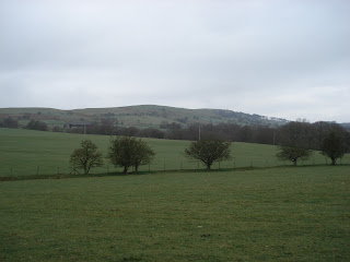
For this training walk, Mark was trying out a touch of lemon juice in his Camelbak. Camelbak suggest its use to give more of a refreshing taste, remove the plastic taste and for anti-bacterial reasons.
Lee arrived at Mark's house for 8.30am and was on time for a change (there you go Red Leader - I said I would let everyone know). For
this training walk, Mark was trying out a touch of lemon juice in his
Camelbak. Camelbak suggest its use to give more of a refreshing taste,
remove the plastic taste and for anti-bacterial reasons. The MapMyHike app was also being given another try as we were in a good mobile reception area.
 |
| Shocking. |
We set off on our usual route to Mow Cop at a decent pace. The 3.6km, 200m ascent to the Folly at the top was managed in 46minutes which is about as fast as we did it with the full team. Having got our passports stamped to cross the border into Staffordshire, we then descended into unknown territory, weaving our way down streets and across fields. There was a bit of confusion where the public footpath left a street and all evidence of said footpath through a farm had been removed. We carried on regardless and soon found that there were stiles present albeit we got the impression we weren't wanted there given they had been electrified with a cattle fencing wire!
 |
| Biddulph. |
Once through the electric fence and across "No Mans Land" which had been badly churned by livestock, the town of Biddulph came into view. Crossing further fields, we came to a another farmyard where the footpath went through it, though the marker was pointing across the field. Realising the marker had been removed and replaced with a single nail allowing it to be spun, we carried on to the farmyard. We were greeted by a friendly farmer who told us we were just in time as they were about to let the cows back out and often they divert people around the farm into the field (hence the marker). Directing us through the farmyard, we hastily made our exit as the thought of charging cows didn't appeal.
 |
| An old platform on the BVW. We apologise for the delay.... |
A short distance later we joined the Biddulph Valley Way (BVW). The BVW is a former railtrack which was once used to carry coal from The Potteries to Congleton and sand on the return journey back (more info can be found
here). The route is now part of Cycle Route 55 and is heavily used by local walkers and cyclists young and old. The section we were on is a gradual descent towards Congleton so we set a good pace along it.
As we got further down, we approached a group of people who were looking at something at the side of the track. The surface of the water seemed to be alive and it turned out to be a myriad of frogs who were spawning. A local lady explained that they return to this same spot to spawn every year. If you listen carefully in the video, you can just about hear them.
 |
| This stile has seen better days. |
A short distance later we veered off the BVW onto a seldom walked public footpath. The stiles were in poor condition and livestock had turned the field into something more reminiscent of The Somme making it heavy going. We then realised we could have stayed on the BVW a bit longer adnd descended onto out intended route which probably explains why it is seldom used and the look of puzzlement on a lady's face who saw us on it (D'oh!). Well, we'll know better for next time. A quick delve into the backpack for an energy bar and a check of the watch suggested we were well ahead of schedule and making good time.
From this point, it was uphill through fields and woodland towards Congleton Edge. This turned out to be a very pleasant route through woodland though again boggy in places and eventually we emerged at a familiar junction at the top of the ridge. Once on the ridge we headed towards the mast at Mow Cop at which point Mark realised his Camelbak was empty, the full 2litres had gone in 3hrs which was either down to the lemon juice or the fact it was a warmer day. Instead of going straight on, we headed down the South Cheshire Way across the fields and through woodland. Again the woodland conditions weren't great with Mark narrowly managing to keep his footing on two occasions.
We ended up entering a field full of cows, at least we thought they were all cows until we approached to find one had a ring through his nose and a quick glance clarified he didn't have an udder. Hastily we edged along the field with half an eye on our curious friend and exited onto the road which took us towards the Start Line for the infamous Mow Cop
Killer Mile.
Following the road back, another glance at the watch suggested we might manage our route in under 4hours so with that in mind we cracked on reaching the finish in 3hrs 50minutes having covered 18.5km with 383m of climb and descent a good 40minutes faster than we expected at an average speed of 4.8km/h. The stats for this walk are
here.
The MapMyHike info is
here (though I forgot to turn it off after the walk had finished!) Not a bad test for it though the elevation data is questionable.
10 Things we learned on this walk:
1. Adding lemon juice to your Camelbak improves the taste and drinkabilty
2. Warmer weather will make you drink more - today was about 650ml/hour
3. Ibuprofen is a surprising performance enhancer
4. Be wary of electrified stiles
5. Cows who don't have udders might not be too friendly
6. Walking through fields full of cows leaves something undesirable on your boots
7. Walking poles may double usefully as cattle prods
8. Walking poles may conduct electricity
9. Thanks to his new knee support, Lee's dodgy knee didn't kick in after 10 miles
10. Setting a target time and beating it is a great training motivation


